Whether you are a nearshore-type person who
doesn’t like to venture too far from the inlet
and just wants to fish and enjoys being out on
the water, or an offshore-type angler who enjoys the long ride
to get to the fishing grounds and wants a chance to hook a
monster fish even if it takes all day to reel it in, there are more
locations available in our area to fish than anyone could dream
of. And if fishing the standard, well-known reefs and structures
is not your cup of tea, then head out and find your own.
You may very well discover a spot that no one has found,
or named. It’ll be yours to brand for fishermen forever to
remember.
46
WBM june 2012
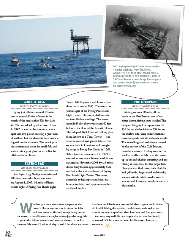
Left: Frying Pan Light Tower draws anglers
44 miles offshore. WBM file photo.
Above: The 523-foot, steel tanker John D.
Gill was torpedoed by a German U-boat in
1942 and is now a favorite spot for anglers
and divers. Photo by Ryan McInnis / www.
InSeaWorldwide.com
John D. Gill
GPS 33 52.350/77 29.010 WR 4
Lying just offshore around 24 miles
out in around 90 feet of water is the
wreck of the steel tanker 523-foot John
D. Gill, torpedoed by a German U-boat
in 1942. It used to be a monster wreck
split into two pieces covering a great deal
of seafloor, but the elements have taken a
big toll on the structure. The wreck provides
substantial cover for small fish and
makes this a great place to wet a line for
offshore-bound boats.
Frying Pan
GPS 33.801 111/77.946 944
The Capt. Greg MicKey, a rechristened
180-foot menhaden boat, was sunk
on August 4, 2007, 44 miles offshore,
within sight of Frying Pan Shoals Light
Tower. MicKey was a well-known local
diver lost at sea in 2005. The wreck lies
within sight of the Frying Pan Shoals
Light Tower. The tower platform sits
on four 80-foot steel legs. The tower
extends 40 feet above water and 40 feet
below to the floor of the Atlantic Ocean.
This adapted Gulf Coast oil drilling platform,
known as a Texas Tower — one
of seven erected and placed into service
— was built in Louisiana and brought
by barge to Frying Pan Shoals in 1966.
When its crew was removed in 1979 it
emitted an automatic beacon until it was
replaced in November 2003 by a 3-meter
discus buoy located approximately 8.22
nautical miles west-southwest of Frying
Pan Shoals Light Tower. The tower,
accessible by helicopter and boat, has
been refurbished and opperates as a bedand
breakfast inn.
The Steeples
GPS 33 13.647/77 15.456
Sitting just over 60 miles off the
beach in the Gulf Stream, one of the
better-known fishing spots is called The
Steeples. Ranging from approximately
450 feet on the backside to 250 feet on
the shallow side, these rock formations
come to a peak, just like a church steeple.
The upwelling and turbulence created
by the current of the Gulf Stream,
provides a massive feeding area for the
smaller baitfish, which have also grown
up in the safe shelter attracting and providing
an easy meal for the larger fish.
Here you can find tuna, both blackfin
and yellowfin, larger-sized mahi-mahi,
wahoo, sailfish, white marlin and, if
you are real fortunate, maybe a shot at a
blue marlin.