43
Good
to
know
Ledges are geographical formations
ranging in height from 5 to 25 feet from the
bottom.
Live bottoms contain seaweed beds,
grass beds, live coral plus other living
things growing on the ledge or rock, and
fish.
Nearshore might only be 100 yards
off the beach, but in reality, it’s a little
farther than that. It’s what the angler
considers it to be, but there is really no
definitive answer. It’s close enough to see
land, which, depending on the visibility, is normally
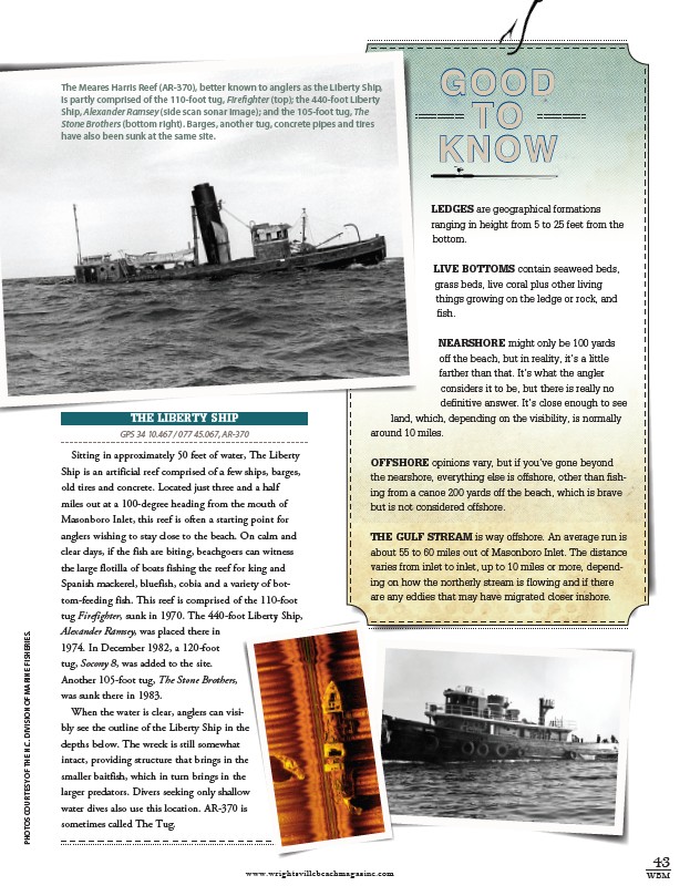
The Meares Harris Reef (AR-370), better known to anglers as the Liberty Ship,
is partly comprised of the 110-foot tug, Firefighter (top); the 440-foot Liberty
Ship, Alexander Ramsey (side scan sonar image); and the 105-foot tug, The
Stone Brothers (bottom right). Barges, another tug, concrete pipes and tires
have also been sunk at the same site.
around 10 miles.
Offshore opinions vary, but if you’ve gone beyond
the nearshore, everything else is offshore, other than fishing
from a canoe 200 yards off the beach, which is brave
but is not considered offshore.
The Gulf Stream is way offshore. An average run is
about 55 to 60 miles out of Masonboro Inlet. The distance
varies from inlet to inlet, up to 10 miles or more, depending
on how the northerly stream is flowing and if there
are any eddies that may have migrated closer inshore.
The Liberty Ship
GPS 34 10.467 / 077 45.067, AR-370
Sitting in approximately 50 feet of water, The Liberty
Ship is an artificial reef comprised of a few ships, barges,
old tires and concrete. Located just three and a half
miles out at a 100-degree heading from the mouth of
Masonboro Inlet, this reef is often a starting point for
anglers wishing to stay close to the beach. On calm and
clear days, if the fish are biting, beachgoers can witness
the large flotilla of boats fishing the reef for king and
Spanish mackerel, bluefish, cobia and a variety of bottom
feeding fish. This reef is comprised of the 110-foot
tug Firefighter, sunk in 1970. The 440-foot Liberty Ship,
Alexander Ramsey, was placed there in
1974. In December 1982, a 120-foot
tug, Socony 8, was added to the site.
Another 105-foot tug, The Stone Brothers,
was sunk there in 1983.
When the water is clear, anglers can visibly
see the outline of the Liberty Ship in the
depths below. The wreck is still somewhat
intact, providing structure that brings in the
smaller baitfish, which in turn brings in the
larger predators. Divers seeking only shallow
water dives also use this location. AR-370 is
sometimes called The Tug.
www.wrightsvillebeachmagazine.com WBM
Photos courtesy of the N.C. Division of Marine Fisheries.