BEACH RENOURISHMENT
In developed areas, periodic sand renourishment helps
protect structures and helps to keep the island “in place.”
Wrightsville Beach is quite stable with the numerous coastal
storm damage reduction projects, a total of 25, that have
been done and continue to be completed every four years.
The renourishment sand for Wrightsville Beach is usually
sourced from Masonboro Inlet. The longshore transport
that moves the sand from north to south also moves some
of that sand into Masonboro Inlet. Sands placed on beaches
must have similar composition and texture to the naturally
occurring sand, so the Masonboro Inlet sands are an excel-lent
source.
(For more about coastal storm damage reduction projects
in our region, see “State of the Sand” by Layton Bedsole in
WBM’s January 2017 edition.)
EROSION
On our beaches, erosion and moving sand are the norm.
The default erosion rate in North Carolina that is used to
guide development is 2 feet per year. Though Wrightsville
Beach erodes less than 2 feet per year because of the peri-odic
renourishment, this value is still used in calculations
of setbacks and planning. Higher erosion rates do occur.
The erosion rate at Kure Beach south of the seawall at Fort
Fisher is up to 9 feet per year; no renourishment occurs
at this location. Parts of Masonboro Island are eroding
at 8 feet per year. The Division of Coastal Management
determines and posts the erosion rates and setbacks for the
North Carolina coast.
LONGSHORE TRANSPORT
One of the obvious changes on the beach is related to
longshore transport, which moves sand along the beach —
the beach front is sometimes called a river of sand.
Imagine a conveyor moving thousands of cubic yards of
sand each year from north to south. The sand movement is
controlled by the wave action and the angle that the waves
impact the beach.
Along Wrightsville Beach, the sand dominantly moves
from north to south. However, it also may move north and
sometimes the waves arrive perpendicular to the beach and
the sand just moves up and back with the waves. This lat-ter
case is when rip currents are most likely; rip currents are
worst at low tide and with waves that arrive perpendicular
to the coastline.
You can experience longshore transport by looking at the
sand movement in the swash zone or you can feel the effect
by floating in the breaker zone. You will be moved down, or
up, the beach away from your towel, depending upon the
direction of longshore transport. Another way to observe
the effects of longshore transport is how the southerly mov-ing
sand piles up on the north side of Wrightsville Beach’s
south-end weir.
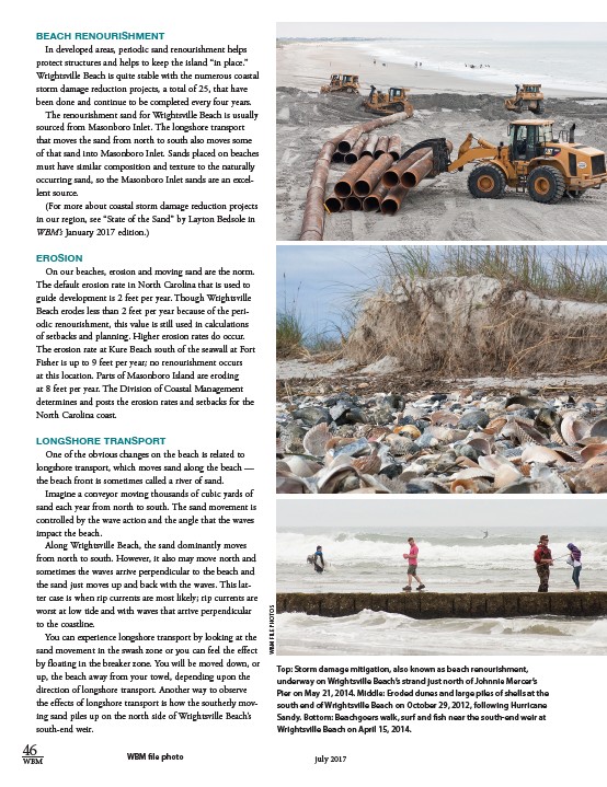
Top: Storm damage mitigation, also known as beach renourishment,
underway on Wrightsville Beach’s strand just north of Johnnie Mercer’s
Pier on May 21, 2014. Middle: Eroded dunes and large piles of shells at the
south end of Wrightsville Beach on October 29, 2012, following Hurricane
Sandy. Bottom: Beachgoers walk, surf and fish near the south-end weir at
Wrightsville Beach on April 15, 2014.
46
WBM file photo
WBM july 2017
WBM FILE PHOTOS