27
Streets
The street names of Wrightsville Beach follow a pattern and a timeline.
“On Wrightsville Beach proper, there are three blocks of names, and they all
correlate to different times,” Cole says.
The first roads were named after some of the earliest families in the area, as in
the case of Stone Street, named after the prominent Stone family.
The initial wave of development was succeeded by the influence of developer
Hugh MacRae’s Consolidated Railways, Light & Power Company (later called
Tidewater Power Company). The company wanted more people to utilize its rail-way,
and a great way to do it was to make sure people knew about the attraction
at the end of the line.
“So the idea was, like with many beach resort towns, to create a destination so
that people had incentive to use your transportation,” Cole says.
Wrightsville was marketed as the “South’s Beach.” Thus, the second block of
streets was named after major Southern cities: Charlotte, Raleigh, Columbia,
Atlanta, Birmingham.
The third stretch of streets, located north of the city-named streets, was con-structed
after Moore’s Inlet closed in 1965,
connecting Wrightsville Beach with Shell
Island, Flagler says. They were given names
that reflect the coastal nature of the town:
Seagull, Shearwater and Sandpiper streets.
The town’s longest street, Lumina Avenue,
is named for the iconic Lumina Pavilion, the
famous attraction built by Tidewater Power
Company in 1905 near the final stop of the
trolley line.
The street follows the path of the original
rail line south, except for the area known as
the Sprunt Compound. When the rails were
taken up, the Sprunt family’s early 1900s ease-ment
reverted to the family in 1939, leaving
the “Sprunt Compound” intact to this day.
Lumina Pavilion took its name from the Latin word for lights; the dance hall
was illuminated by more than 1,000 light bulbs. Although the building no longer
exists, its legend lives on in the annual Lumina Daze event held by the museum
and the avenue Wrightsville Beach residents and visitors drive every day.
www.wrightsvillebeachmagazine.com WBM
James Sprunt
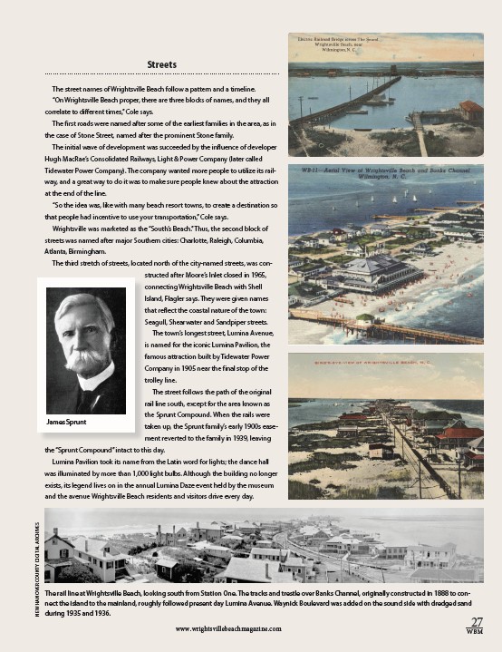
The rail line at Wrightsville Beach, looking south from Station One. The tracks and trestle over Banks Channel, originally constructed in 1888 to con-nect
the island to the mainland, roughly followed present day Lumina Avenue. Waynick Boulevard was added on the sound side with dredged sand
during 1935 and 1936.
NEW HANOVER COUNTY DIGITAL ARCHIVES