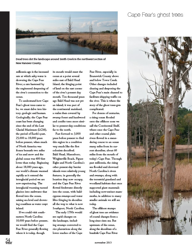
Cape Fear’s ghost trees Dead trees dot the landscape around Smith Creek in the northwest section of
New Hanover County.
millennia ago is the increased
rate at which salty water is
drowning the Cape Fear
River; a rate hastened by
the engineered deepening of
the river’s connection to the
ocean.
To understand how Cape
Fear’s ghost trees came to
be, we must delve into his-tory,
geologic and human.
Geologically, the Cape Fear
coast has been changing
since the end of the Last
Glacial Maximum (LGM),
the period of Earth’s past,
25,000 to 18,000 years
before present, when much
of North America was
frozen beneath two miles
of ice and snow and the
global ocean was 400 feet
lower than today. Beginning
about 18,000 years ago,
our world’s climate warmed
rapidly as it entered the
interglacial period we are
now experiencing. The
interglacial warming turned
glaciers into meltwater that
flowed into the ocean,
raising sea level and drown-ing
coastlines as water crept
inland.
If we could visit south-eastern
North Carolina
10,000 years before present,
we would find the Cape
Fear River generally flowing
where it is today, though
its mouth would meet the
ocean at a point several
miles east of Bald Head
Island, the fringing point
of land on the east corner
of the river’s present day
mouth. Ten thousand years
ago Bald Head was not yet
an island; it was part of
the continental mainland,
a realm then covered by
swamp forest and hardwood
and conifer trees more simi-lar
to present-day conditions
far to the north.
Fast forward to 3,000
years before present to find
this region in a condition
very much like the first
colonists described.
Bald Head, Masonboro,
Wrightsville Beach, Figure
Eight and North Carolina’s
other present-day barrier
islands were relatively young
features, in generally the
location they now occupy,
and the Cape Fear River
flowed freshwater directly
into the ocean, with bald-
cypress swamps and water
lilies fringing its shoreline
all the way to what is now
Southport, North Carolina.
The early 1700s would
see rapid changes on
the landscape, includ-ing
swamps converted to
rice plantations along the
lower reaches of the Cape
Fear River, especially in
Brunswick County above
and below Town Creek.
Other changes included
clearing and deepening the
Cape Fear’s main channel to
facilitate shipping traffic on
the river. This is where the
story of the ghost trees gets
complicated.
For dozens of centuries,
a rising ocean flooded
onto the offshore zone we
call the Continental Shelf,
where once the Cape Fear
and other coastal plain
rivers flowed in a mean-dering
course to an ocean
many miles from its cur-rent
shoreline, about 60
miles from the mouth of
today’s Cape Fear. Through
past millennia, the rising
sea flooded and drowned
North Carolina’s rivers
and swamps, along with
the terrestrial grassland and
woodland habitats that once
supported giant mammals
including now-extinct mam-moths,
in addition to many
smaller animals we still see
today.
The offshore stumps
of ghost trees are evidence
of coastal changes from a
long since risen sea. But
upstream of the ocean,
along the shorelines of a
brackish Cape Fear River
54
WBM november 2013