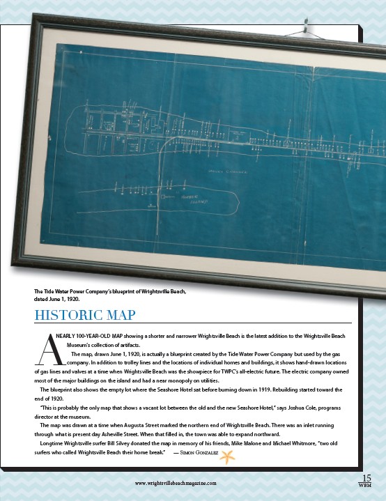
The Tide Water Power Company’s blueprint of Wrightsville Beach,
dated June 1, 1920.
CREDIT
HISTORIC MAP
A
NEARLY 100-YEAR-OLD MAP showing a shorter and narrower Wrightsville Beach is the latest addition to the Wrightsville Beach
Museum’s collection of artifacts.
The map, drawn June 1, 1920, is actually a blueprint created by the Tide Water Power Company but used by the gas
company. In addition to trolley lines and the locations of individual homes and buildings, it shows hand-drawn locations
of gas lines and valves at a time when Wrightsville Beach was the showpiece for TWPC’s all-electric future. The electric company owned
most of the major buildings on the island and had a near monopoly on utilities.
The blueprint also shows the empty lot where the Seashore Hotel sat before burning down in 1919. Rebuilding started toward the
end of 1920.
“This is probably the only map that shows a vacant lot between the old and the new Seashore Hotel,” says Joshua Cole, programs
director at the museum.
The map was drawn at a time when Augusta Street marked the northern end of Wrightsville Beach. There was an inlet running
through what is present day Asheville Street. When that filled in, the town was able to expand northward.
Longtime Wrightsville surfer Bill Silvey donated the map in memory of his friends, Mike Malone and Michael Whitmore, “two old
surfers who called Wrightsville Beach their home break.” — Simon Gonzalez
15
www.wrightsvillebeachmagazine.com WBM