
What’s in a Name?
BY Annie Stevens
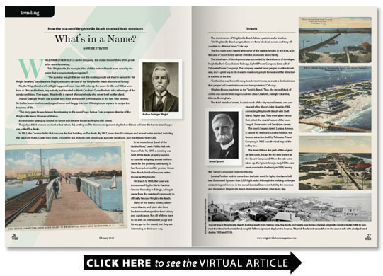
While names themselves can be intriguing the stories behind them often prove to be more fascinating.
Take Wrightsville for example. How did this beloved beach town come by the name that is now instantly recognized?
“The question we get that we love the most is people ask if we’re named for the Wright brothers ” says Madeline Flagler executive director of the Wrightsville Beach Museum of History.
No the Wright brothers’ first flight happened more than 200 miles up the coast. Orville and Wilbur were born in Ohio and Indiana respectively and traveled to North Carolina’s Outer Banks to take advantage of the windy conditions. Then again Wrightsville is named after somebody who never lived on the island.
Joshua Grainger Wright was a judge who lived and worked in Wilmington in the late 18th century. He built a house on the sound a good horse-and-buggy ride from Wilmington as a place to escape the busyness of life.
“The story goes he was famous for retreating to the sound ” says Joshua Cole programs director of the Wrightsville Beach Museum of History.
A community sprang up around his house and became known as Wrightsville Sound.
The judge didn’t venture any farther but others did settling on The Hammocks (present-day Harbor Island) and later the barrier island opposite called The Banks.
In 1853 the Carolina Yacht Club became the first building on The Banks. By 1897 more than 50 cottages and several hotels existed including the Seashore Hotel Ocean View Hotel a home for sick children (still standing as a private residence) and the Atlantic Yacht Club.
In his iconic book “Land of the Golden River ” Lewis Phillip Hall tells that on Feb. 16 1897 a meeting was held of The Banks property owners to consider adopting a more uniform name for the growing community. It had been advertised for years as Ocean View Beach but had become better known as Wrightsville.
On March 6 1899 the town was incorporated by the North Carolina General Assembly in Raleigh taking its name from the mainland community to officially become Wrightsville Beach.
Many of the town’s streets waterways islands and piers also have backstories that speak to their history and significance. Not all of them have to do with an overworked judge and his escape to the sound but they are interesting in their own way.
Streets
The street names of Wrightsville Beach follow a pattern and a timeline.
“On Wrightsville Beach proper there are three blocks of names and they all correlate to different times ” Cole says.
The first roads were named after some of the earliest families in the area as in the case of Stone Street named after the prominent Stone family.
The initial wave of development was succeeded by the influence of developer Hugh MacRae’s Consolidated Railways Light & Power Company (later called Tidewater Power Company). The company wanted more people to utilize its railway and a great way to do it was to make sure people knew about the attraction at the end of the line.
“So the idea was like with many beach resort towns to create a destination so that people had incentive to use your transportation ” Cole says.
Wrightsville was marketed as the “South’s Beach.” Thus the second block of streets was named after major Southern cities: Charlotte Raleigh Columbia Atlanta Birmingham.
The third stretch of streets located north of the city-named streets was constructed after Moore’s Inlet closed in 1965 connecting Wrightsville Beach with Shell Island Flagler says. They were given names that reflect the coastal nature of the town: Seagull Shearwater and Sandpiper streets.
The town’s longest street Lumina Avenue is named for the iconic Lumina Pavilion the famous attraction built by Tidewater Power Company in 1905 near the final stop of the trolley line.
The street follows the path of the original rail line south except for the area known as the Sprunt Compound. When the rails were taken up the Sprunt family’s early 1900s easement reverted to the family in 1939 leaving the “Sprunt Compound” intact to this day.
Lumina Pavilion took its name from the Latin word for lights; the dance hall was illuminated by more than 1 000 light bulbs. Although the building no longer exists its legend lives on in the annual Lumina Daze event held by the museum and the avenue Wrightsville Beach residents and visitors drive every day.
Waterways
Banks Channel the waterway separating The Hammocks from the barrier island has a debated backstory. Some people say it received its name from the original name of the barrier island The Banks or New Hanover Banks. Others say it was named after the Banks family.
The origins of Lees Cut and Motts Channel are less debated. They were both named after two influential families. The Mott family were early settlers of New Hanover County. Wilmington historian and Citadel professor Lawrence Lee became president of Shore Acres which developed North and South Harbor Island.
“They’re much bigger in the later ’20s and ’30s ” Cole says. “They come onto the scene a little bit later and they are the second wave of development.”
Of Men and Islands
Harbor Island’s original name The Hammocks came from the small hardwood trees that grow on elevated areas in wetlands.
“It wasn’t until the Tidewater Power Company set up a stop there that they renamed it Harbor Island ” says Joseph Sheppard a librarian at the New Hanover County Library’s North Carolina Room.
Across Moore’s Inlet at Wrightsville’s northern end Shell Island received its name from the mounds of shells found in the sand.
“People would go up there to get shells ” Cole says. “If you wanted to get away go off by yourself you would go to Shell Island.”
Money Island just south of Bradley Creek Point and immediately east of Shandy Hall opposite the mainland shoreline has a name rooted in pirate lore. Local legend says that Capt. William Kidd buried treasure there in about 1699.
“Its kind of a mystery place ” Sheppard says. “There are all those wild stories about pirates and buried treasure. But you know it’s always possible.”
Piers and People
Wrightsville’s iconic concrete pier was originally wooden and called Atlantic View Fishing Pier before longtime owner Johnnie Mercer bought it in 1939. Singer/songwriter Johnny Mercer was very popular around the time which led to some confusion.
Waynick Boulevard was constructed during 1935 and 1936 from sand dredged next to Banks Channel on the west side of Lumina Avenue. The name was bestowed to honor the department of transportation engineer who designed the project.
The Heide Trask Drawbridge connecting Wrightsville to the mainland was completed in 1958 replacing the original drawbridge constructed in 1928. The bridge was named for North Carolina highway commissioner C. Heide Trask.
Wynn Plazais a memorial to firefighter Lt. Robert M. Wynn who lost his life battling the blaze that destroyed theDoak Apartmentsin 1981.
The John Nesbitt Loop the 2.47-mile paved trail that circles Wrightsville Beach Park along Causeway Drive and Salisbury Street and is a favorite for runners and walkers is named for the town’s former public works director. John Nesbitt saw the need for residents to be able to walk to and from the post office safely and he and his employees began construction of a sidewalk during their slow months using undedicated funds.
“He did it very ad-hoc so anytime someone was pouring concrete on the beach he would take some of it ” Cole says. “That’s why the sidewalk is really patchy. They laid it just as they had stuff.”
The Loop was originally dedicated on January 9 1992. In 2006 the Wrightsville Beach Board of Aldermen named the walkway the John Nesbitt Loop and unveiled a sidewalk marker honoring his contributions to the town.