
Shifting Sand
BY Roger Shew
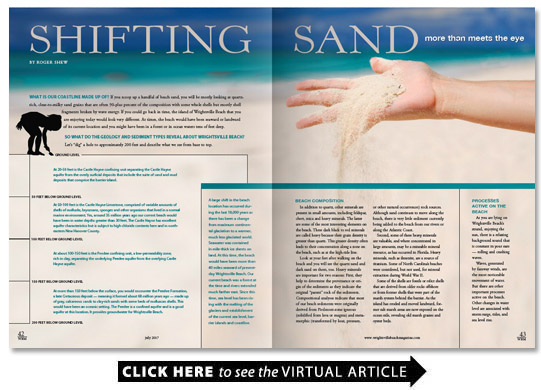
What is our coastline made up of? If you scoop up a handful of beach sand you will be mostly looking at quartz-rich clear-to-milky sand grains that are often 90-plus percent of the composition with some whole shells but mostly shell fragments broken by wave energy. If you could go back in time the island of Wrightsville Beach that you are enjoying today would look very different. At times the beach would have been seaward or landward of its current location and you might have been in a forest or in ocean waters tens of feet deep.
So what do the geology and sediment types reveal about Wrightsville Beach? Let’s “dig” a hole to approximately 200 feet and describe what we see from base to top.
Ground level to 50 Feet below Ground level
At 20-50 feet is the Castle Hayne confining unit separating the Castle Hayne aquifer from the overly surficial deposits that include the suite of sand and mud deposits that comprise the barrier island.
50 Feet to 100 Feet below Ground level
At 50-100 feet is the Castle Hayne Limestone comprised of variable amounts of shells of mollusks bryozoans sponges and other organisms that lived in a normal marine environment. Yes around 35 million years ago our current beach would have been in water depths greater than 30 feet. The Castle Hayne has excellent aquifer characteristics but is subject to high chloride contents here and in northeastern New Hanover County.
100 Feet to 150 Feet below Ground level
At about 100-150 feet is the Peedee confining unit a low-permeability zone rich in clay separating the underlying Peedee aquifer from the overlying Castle Hayne aquifer.
150 Feet to 200 Feet below Ground level
At more than 150 feet below the surface you would encounter the Peedee Formation a late Cretaceous deposit — meaning it formed about 68 million years ago — made up of gray calcareous sands to clay-rich sands with some beds of molluscan shells. This would have been an oceanic setting. The Peedee is a confined aquifer and is a good aquifer at this location. It provides groundwater for Wrightsville Beach.
A large shift in the beach location has occurred during the last 18 000 years as there has been a change from maximum continental glaciation to a warmer much less glaciated world. Seawater was contained in mile-thick ice sheets on land. At this time the beach would have been more than 40 miles seaward of present-day Wrightsville Beach. Our current beach was a forest at the time and rivers extended much farther east. Since this time sea level has been rising with the melting of the glaciers and establishment of the current sea level barrier islands and coastline.
Beach Composition
In addition to quartz other minerals are present in small amounts including feldspar chert mica and heavy minerals. The latter are some of the most interesting elements on the beach. These dark black to red minerals are called heavy because their grain density is greater than quartz. This greater density often leads to their concentration along a zone on the beach such as at the high-tide line.
Look at your feet after walking on the beach and you will see the quartz sand and dark sand on them too. Heavy minerals are important for two reasons: First they help to determine the provenance or origin of the sediments as they indicate the original “parent” rock of the sediments. Compositional analyses indicate that most of our beach sediments were originally derived from Piedmont-zone igneous (solidified from lava or magma) and metamorphic (transformed by heat pressure or other natural occurrences) rock sources. Although sand continues to move along the beach there is very little sediment currently being added to the beach from our rivers or along the Atlantic Coast.
Second some of these heavy minerals are valuable and where concentrated in large amounts may be a mineable mineral resource as has occurred in Florida. Heavy minerals such as ilmenite are a source of titanium. Some of North Carolina’s beaches were considered but not used for mineral extraction during World War II.
Some of the shells are fossils or relict shells that are derived from older rocks offshore or from former shells that were part of the marsh system behind the barrier. As the island has eroded and moved landward former salt marsh areas are now exposed on the ocean side revealing old marsh grasses and oyster beds.
Processes Active on the Beach
As you are lying on Wrightsville Beach’s strand enjoying the sun there is a relaxing background sound that is constant in your ears — rolling and crashing waves.
Waves generated by faraway winds are the most noticeable movement of water. But there are other important processes active on the beach. Other changes in water level are associated with storm surge tides and sea level rise.
Storm surge
Occurring with the passage of tropical storms and hurricanes storm surge is the mounding up of water particularly on the northeast quadrant of the storm as it approaches the coast. The northeast quadrant will be the most hazardous both because of increased wind speeds and storm surge. Storm surge will be higher with more intense storms; Hazel (Category 4 hurricane in 1954) had a storm surge of 17 feet while Fran (Category 3 hurricane in 1996) had a storm surge of 10 feet. Storm surge is usually the most damaging aspect of hurricanes though as we know from Floyd (1999) and Matthew (2016) flooding may sometimes be the most costly and deadly.
Tidal range
Wrightsville Beach has a tidal range of approximately 4.5 feet. There are two high and two low tides each day of approximately equal magnitude; these are termed semi-diurnal tides. Storm surge that coincides with the high tide or particularly with the spring high tide will be much more damaging.
Our average wave heights are only 2-3 feet but in storms they are much larger. These storm waves impact deeper water and will put more of the sand into motion.
Sea level rise
On short time scales sea level rise and fall is very small; though we know that sea level has varied dramatically over time. Just 18 000 years ago sea level was approximately 400 feet lower than today.
Sea level rise is an important issue on our low-lying coast. A 2015 report by the Science Panel of the Coastal Resources Commission was completed to provide current and projected sea level rise along the coast. It states that Wilmington has a yearly sea level rise currently of just over .08 inches per year.
Over a 30-year timeframe which is the projection period in the report the rise in sea level would be approximately 2.5 inches in Wilmington. However depending upon the scenario it may be as much as 5.4 inches. These sound like small numbers but our coastline is very flat which leads to more areal flooding even with a small rise.
Most of North Carolina’s coastline has a moderate-to-high vulnerability to sea-level rise. A rise of 14 inches would inundate more than 700 square miles mostly in northeastern North Carolina. Southeastern North Carolina is not as flat and our rate of rise is less — geology does make a difference. As a point of reference the maximum elevation on Wrightsville is just over 10 feet with much of it less than 5 feet; the average is 7 feet.
Barrier Islands
Barrier islands are one of the most dynamic natural environments on Earth. They are literally changing every day.
In addition to movement caused by longshore transport they may move seaward or landward because of storm erosion and sea level falls and rises. A barrier island moving seaward is termed progradational. Moving landward is retrogradational.
Natural landward migration is termed island rollover. Rollover is obvious on undeveloped islands where sand is transported from the beach to the marsh during storms. Storm waves and surge breach the dunes and deposit sand in an overwash fan on the landward side of the island.
At Wrightsville Beach the island’s houses create a barrier to sand movement. However overwash fans and landward migration are easily seen on the undeveloped Masonboro and Lea-Hutaff islands as well as at the north end of Carolina Beach and on Kure Beach in front of the North Carolina Aquarium at Fort Fisher. Yes the beach is moving toward the aquarium.
So as you lie on your towel think about the moving sands and the changing landscape and know that the only constant on a barrier island is change. But then return to the beauty of sun surf and sand and enjoy one of the golden treasures of our region that should be cherished and protected.
Beach renourishment
In developed areas periodic sand renourishment helps protect structures and helps to keep the island “in place.” Wrightsville Beach is quite stable with the numerous coastal storm damage reduction projects a total of 25 that have been done and continue to be completed every four years.
The renourishment sand for Wrightsville Beach is usually sourced from Masonboro Inlet. The longshore transport that moves the sand from north to south also moves some of that sand into Masonboro Inlet. Sands placed on beaches must have similar composition and texture to the naturally occurring sand so the Masonboro Inlet sands are an excellent source.
(For more about coastal storm damage reduction projects in our region see “State of the Sand” by Layton Bedsole in WBM’s January 2017 edition.)
Erosion
On our beaches erosion and moving sand are the norm. The default erosion rate in North Carolina that is used to guide development is 2 feet per year. Though Wrightsville Beach erodes less than 2 feet per year because of the periodic renourishment this value is still used in calculations of setbacks and planning. Higher erosion rates do occur. The erosion rate at Kure Beach south of the seawall at Fort Fisher is up to 9 feet per year; no renourishment occurs at this location. Parts of Masonboro Island are eroding at 8 feet per year. The Division of Coastal Management determines and posts the erosion rates and setbacks for the North Carolina coast.
Longshore Transport
One of the obvious changes on the beach is related to longshore transport which moves sand along the beach — the beach front is sometimes called a river of sand.
Imagine a conveyor moving thousands of cubic yards of sand each year from north to south. The sand movement is controlled by the wave action and the angle that the waves impact the beach.
Along Wrightsville Beach the sand dominantly moves from north to south. However it also may move north and sometimes the waves arrive perpendicular to the beach and the sand just moves up and back with the waves. This latter case is when rip currents are most likely; rip currents are worst at low tide and with waves that arrive perpendicular to the coastline.
You can experience longshore transport by looking at the sand movement in the swash zone or you can feel the effect by floating in the breaker zone. You will be moved down or up the beach away from your towel depending upon the direction of longshore transport. Another way to observe the effects of longshore transport is how the southerly moving sand piles up on the north side of Wrightsville Beach’s south-end weir.
What is a barrier island?
The barrier islands in southeastern North Carolina are a narrow thin veneer of sand sandwiched between offshore sand-poor areas and marsh grasses and muds on the landward side of the island. Our simple narrow barrier islands are termed sand-starved more subject to overwash than the wider barriers that are termed complex and are more stable.
The barrier islands are comprised of sediments that have moved landward across the continental shelf as sea levels have risen since the last major glaciation 18 000 years ago. There is very little new sand being added as most of the rivers carry little sediment to the beaches. The Cape Fear has multiple dams on the river limiting coarser sediments from moving downstream.
The sediments that compose the barriers have been moving landward over the past 10 000 years. These are termed Holocene deposits (the youngest geologic age). There is an effort underway to name the last several hundred years the Anthropocene (age of humans) because of the significant impact of humans on our changing world.
Most of our barriers are retrogradational meaning they are moving landward with rising seas and with storm activity moving sand across the island in the island rollover.
When you core through the island sands you will find old ocean sediments and just below the thin sand veneer of the barrier you will often encounter marsh sediments. In fact old marsh sediments may be seen in the wave zone on several beaches including Topsail Masonboro and Oak islands. These old Spartina marshes which were once living behind the barrier islands have been exposed as the islands retreat landward.
The other aspect of variability both on and under our barrier islands is the most dynamic part of the barrier island environment — the tidal inlets. These are defined by constant movement and of course today are the subject of hot debate for shoaling and dredging terminal groin placement and the often-conflicting interests of homes and ecosystems — both of which may be in jeopardy with shifting inlets.
Wrightsville Beach certainly has abundant experience with changing inlets. There was an inlet formerly present near the Holiday Inn called Moore’s Inlet. It separated Wrightsville Beach from Shell Island. When it closed in 1965 the two islands became one.
Mason Inlet at the north end of Wrightsville Beach has a complex history too. It moved thousands of feet south and put Shell Island Resort and other houses at risk in the late 1990s and early 2000s. It was moved approximately 3 000 feet to the north to its current location in 2002. Masonboro Inlet has been stabilized with the construction of the north (1966) and south (1980) jetties.