Life Span
Beach bridges coming down and going up
BY Pat Bradford
As the only land access to Wrightsville Beach and Harbor Island, the Heide Trask Drawbridge can create a love-hate relationship with those who routinely cross it or who find themselves frustrated sitting in vehicles waiting for it to go down.
Residents, commuters and visitors know when it’s up, broken, or under construction.
However, there are three additional bridges that receive a lot less attention, unless you’re stuck at one of them in maintenance mode when you’re trying to reach the beach in June or July. These three bridges are vital to those wanting to reach the barrier island of Wrightsville Beach and its beach strand by land.
Looming on the horizon are significant changes to all the access points over Banks Channel between the islands of Harbor Island and Wrightsville Beach.
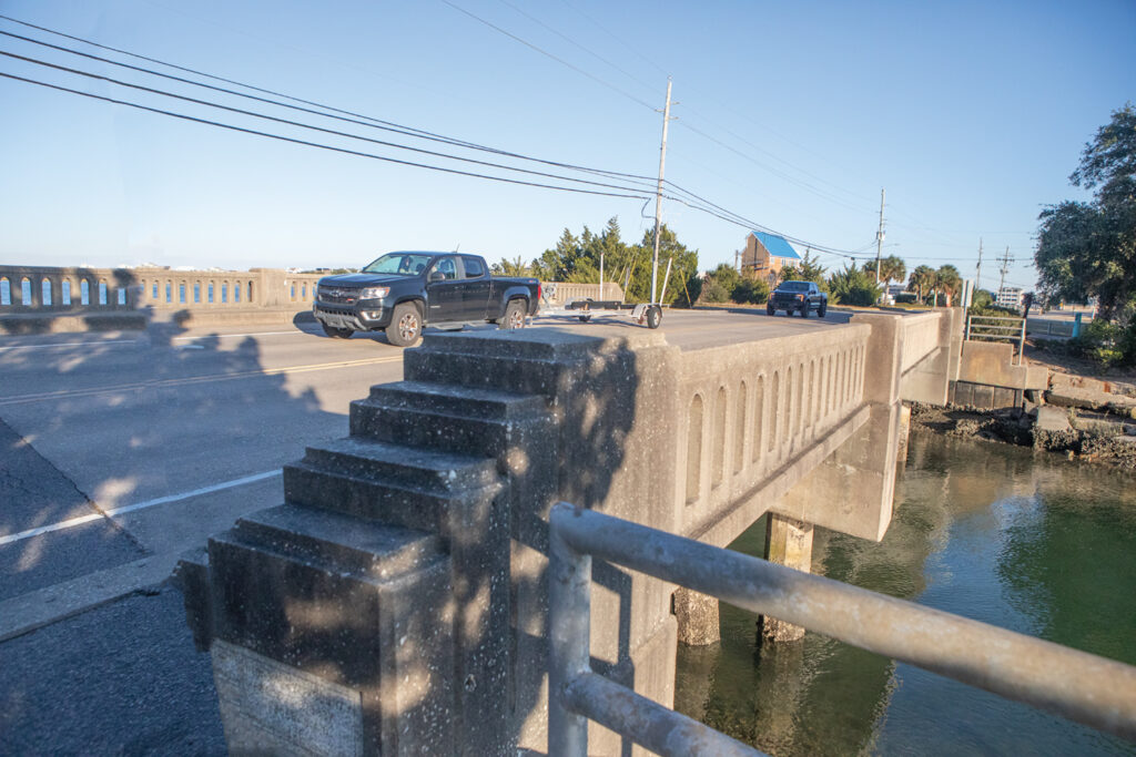
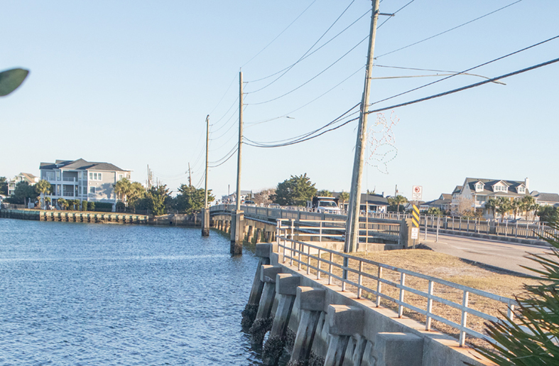
All three are fixed bridges. Two are on the U.S. 74 accessway of Salisbury Street, leading to and away from the pier area and the northern portion of Wrightsville. The third is the Causeway Drive accessway, U.S. 76 to the southern end of Wrightsville and also the closest to the boutique downtown district.
The bridge over Banks Channel on Causeway Drive is known as Bridge 21 to the North Carolina Department of Transportation (NCDOT). On West Salisbury Street, Bridge 22 spans Keenan’s Creek as it enters Lees Cut. Bridge 24 over Banks Channel connects Harbor Island to the Wrightsville middle portion and the northern portion at the pier.
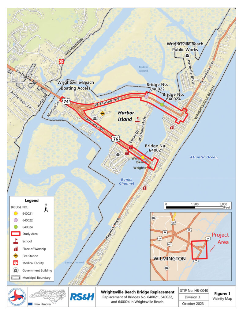
NCDOT released rebuild proposals for each bridge in January 2024. Renderings include high-demand multiuse paths and bike lanes. Fieldwork was conducted during July and August 2023.
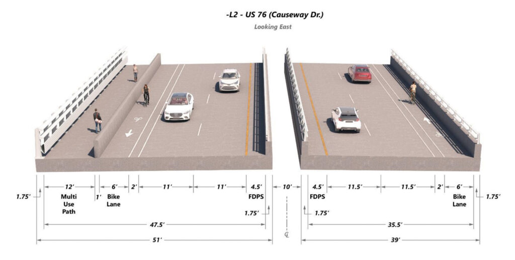
Causeway Drive’s Bridge 21 is proposed to be replaced by two bridges. A new eastbound bridge will have two 11.5-foot lanes traveling onto the island, while the westbound bridge will be slightly narrower, with two 11-foot lanes leaving the island.
They include a 12-foot multiuse path on the north side of the westbound bridge and a 6-foot bike lane on both bridges. Each bridge will be raised above the 12-foot average base flood elevation in that area.
The purpose of the replacement is safety. Even though NCDOT just completed two years of work on Bridge 21, it is designated structurally deficient.
The report says Bridge 21 has a sufficiency rating of 8.7 out of a possible 100. Bridge 24, with a sufficiency score of 44, was also deemed structurally deficient. Bridge 22 fared the best with a rating of 81.5.
The replacement will begin on the Causeway. This is estimated to have the most impact, affecting not only traffic flow but that of children accessing Wrightsville Beach School.
To replace the two-lane Causeway Drive bridge with two new bridges, the DOT will take property on both sides of Banks Channel, on the north side of the existing bridge impacting the 20 condominium owners on the west side as well as two on the east side.
A DOT project report (HB-0040) dated Jan. 2, 2024, shows the state will condemn and relocate 22 residential units and one business in order to change the bridge approach.
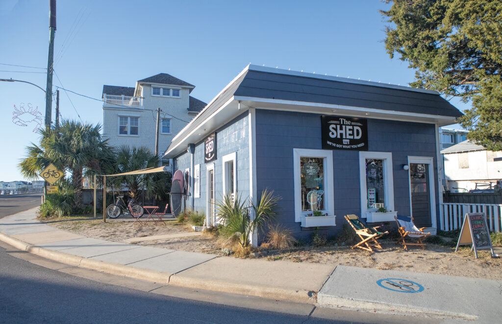
This will include the relocation of The Shed, a year-round coffee, ice cream, bike, surf apparel, and rental business. The commercial location is described in the report as impeding the sight of drivers as they approach the Lumina Avenue traffic signal.
Jennifer Barker is one of six townhome-style condominium owners in three buildings constructed in 1997 on Channel Avenue on the east side of the bridge. The construction in 1997 was not without controversy over a height violation. A violation of the town’s height restriction required the roof line be reduced by inches.
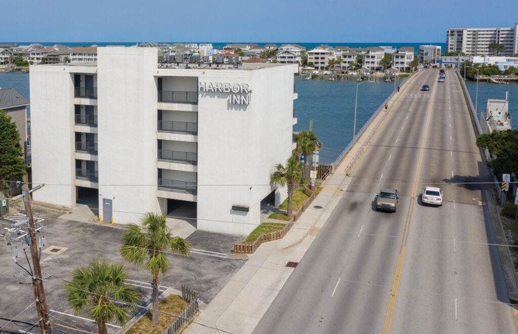
Barker says the DOT told her they plan to buy the Harbor Inn and one building in her Channel Avenue complex for bridge construction, but not until she contacted them. There was no notice.
She owns a unit in the middle building. She has questions.
“Yes, there’s a big document. But it doesn’t address the logistics of how this is going to operate,” she says.
She says the estimated time given to her by the DOT for these purchases is the spring of 2026. She wonders why the town didn’t reach out to the homeowners.
“There’s a lot of unknowns,” she says. “We’d like to see some answers. What are the tax implications of this? There are questions, should our homeowner association paint that building or do repairs?”
The homeowners’ maintenance fee is more than $1,000 per month.
Seven Causeway construction proposals were considered during public meetings in August and October 2023. The Aug. 28, 2023, meeting can be found online at NCDOT.
The public comment period ended Oct. 10, 2023, with 427 comments.
No. 20 Channel Avenue Unit B was listed for sale during the summer of 2024 at a price of $1.856 million and was under a contingency contract at the end of early December 2024.
“It looks like somebody bought it. That’s interesting that it still sold [knowing this]. Our HOA only found out about it because the unit was going to be sold,” Barker says.
Channel Avenue has been blocked where it intersects Lumina Avenue and Causeway Drive, creating a narrow, dead-end alley. Barker worries the DOT will open the alleyway to traffic during the two years of bridge construction.
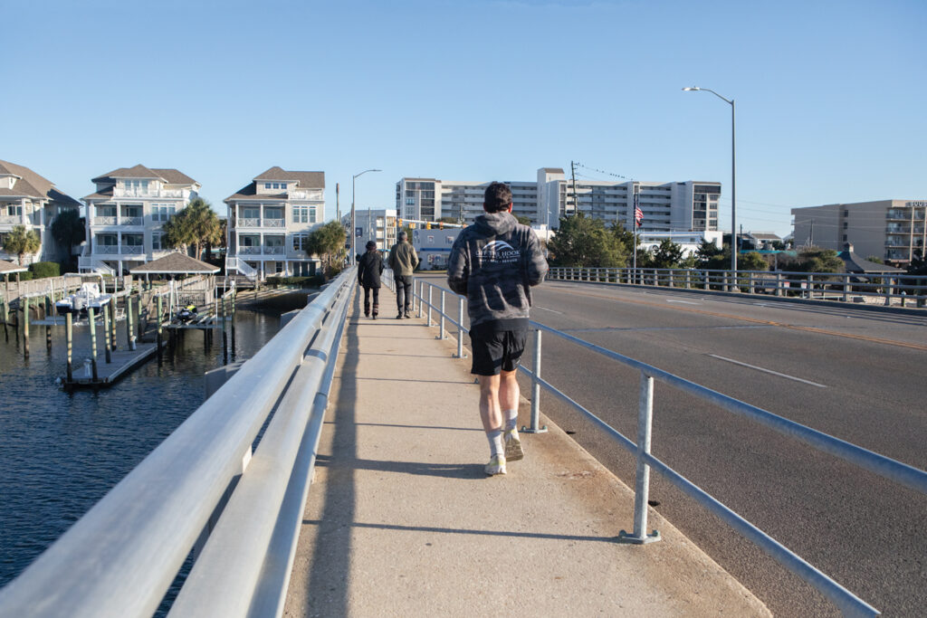
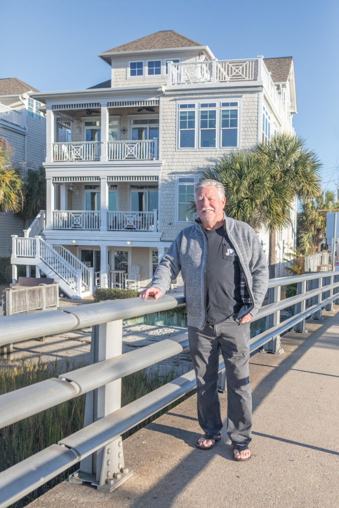
She worries about how close this new bridge will come to her condo and has concerns the 12-foot bridge height will negatively impact her privacy.
John Martin, owner of 20 Channel Ave Unit A, the top floor unit of the building the DOT has identified to be demolished, has owned his unit for five years. He and his wife enjoy it as a winter home but use upwards of $20,000 in vacation rental income in the summer to augment their Social Security checks and pay the taxes and insurance on the unit.
“They spent two years working on that bridge. Now this,” Martin says. “It really hurts me. Now they’re going to tear it down.”
On the Harbor Island side at 701 Causeway Drive, all 20 Harbor Inn units are slated to be torn down.
The owner of the property did not have the details of the state’s acquisition plan.
Each bridge will have sections closed for construction, with an estimated duration of 24 months. Pedestrian access will be limited during all big bridge construction and there will be detours.
Funding will come from the NCDOT bridge program. It is currently funded for preliminary engineering only.
Estimated cost for construction as of February 2024 was $78.75 million. This included right-of-way acquisition cost of $32.2 million, utility relocation at $1.95 million, and $44.6 million in construction costs.
Martin says he is looking for the DOT to give him replacement value for his waterfront unit. “I have a fishing pier, dock, a boat and boat lift. I want replacement and I want it on the island,” he says.
